Golden Creek Project
High-grade gold in soils to 6.04 g/t Au, alluvial gold nuggets in creeks, and an epithermal vein at the heart of a coincident copper anomaly.
A frontier gold province with limited modern exploration
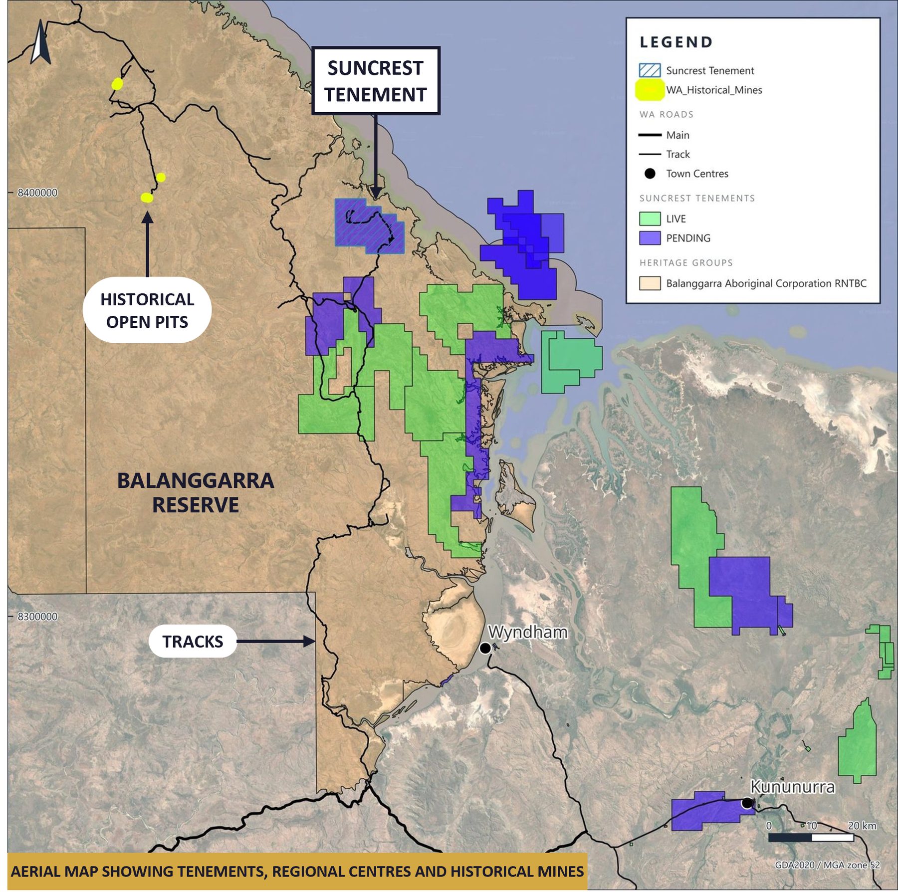
Golden Creek is Suncrest Gold's discovery option in the remote North Kimberley. The tenure (E80/6242, 50 blocks) is under application over Aboriginal Lands Trust reserve land within the Balanggarra native title area; consent of the Department of Planning, Lands and Heritage and the ALT is required and the reserve referral has been lodged.
Access is approximately 250 km from Kununurra by sealed road to Home Valley Station, then station and historical exploration tracks. Kununurra provides a well-established regional centre with hospital, accommodation, airport and mining support services.
A regionally significant alteration system, identified by De Beers
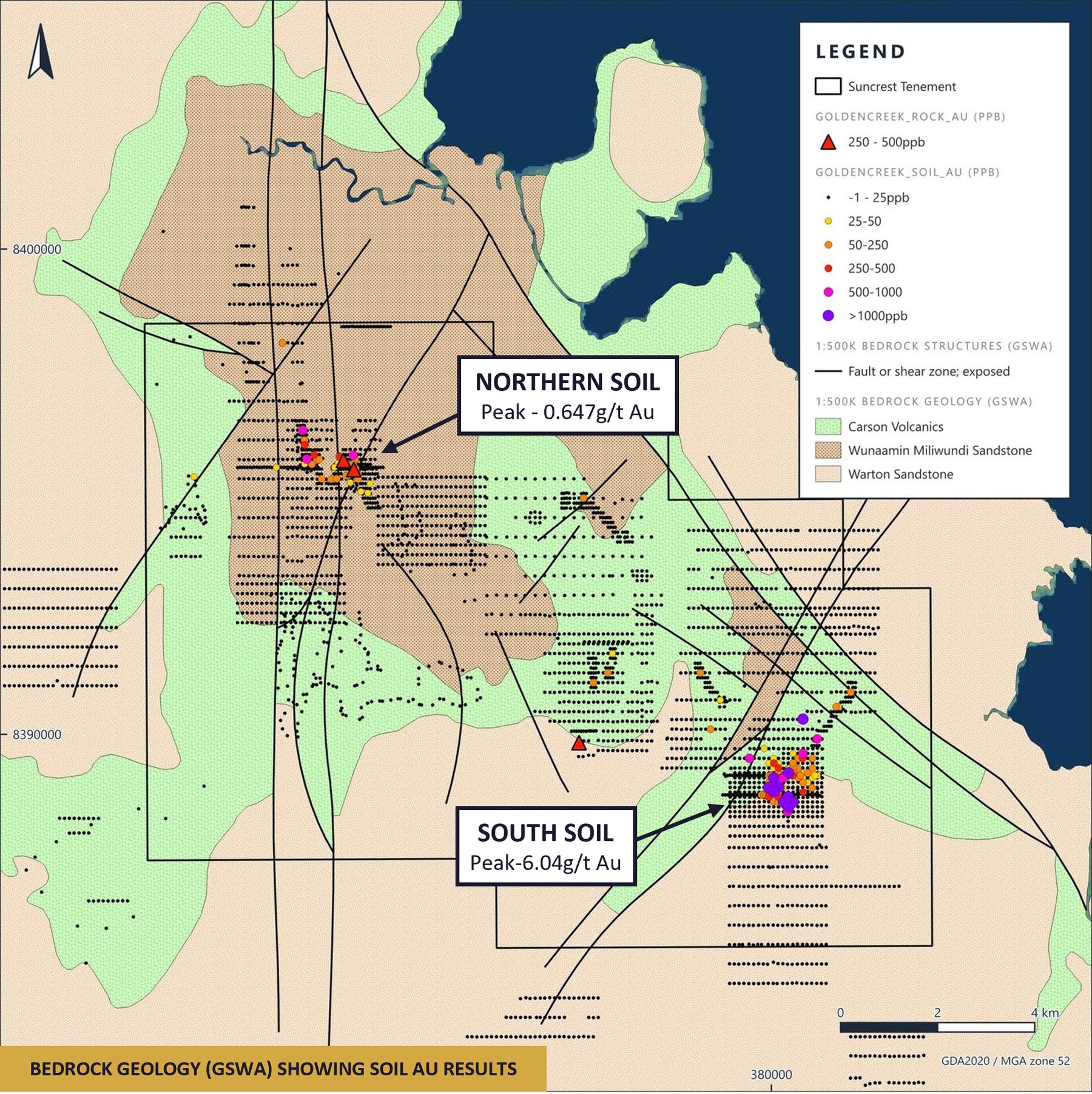
Golden Creek was originally a diamond target. De Beers' multispectral survey over the Kimberley defined a widespread argillic (hydrothermal) alteration zone of approximately 70 × 20 km, confirmed by ground reconnaissance. Regional stream-sediment sampling then returned visible gold nuggets in the Golden Creek area, and follow-up soil sampling defined two coherent gold-in-soil anomalies — North (peak 0.647 g/t Au) and South.
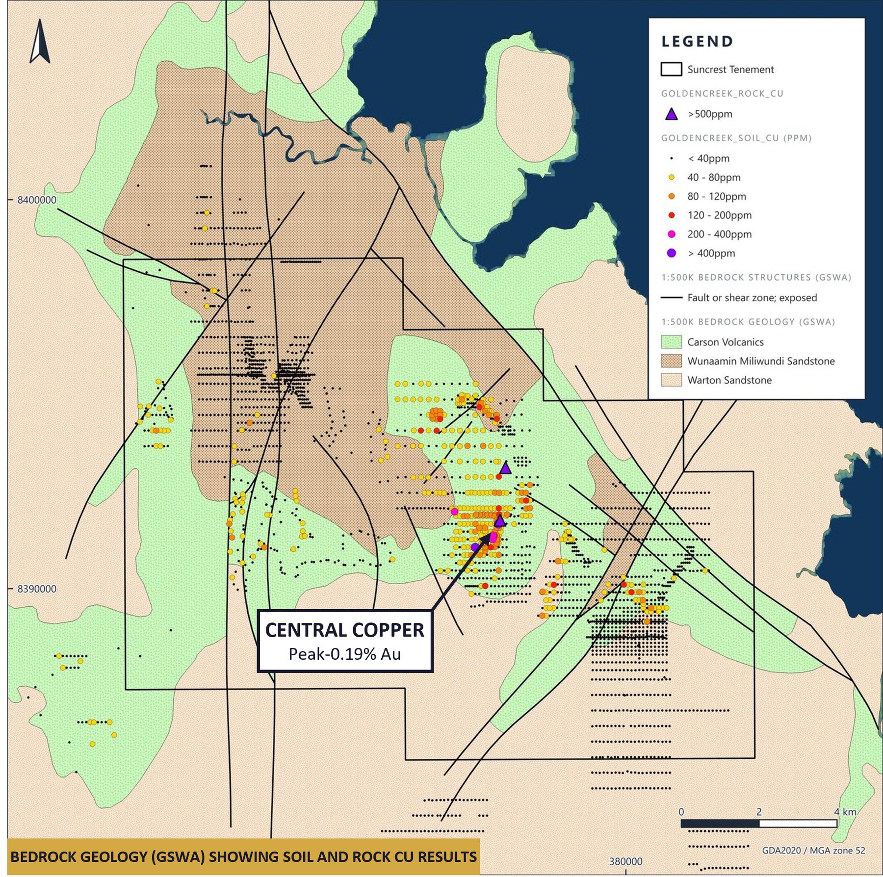
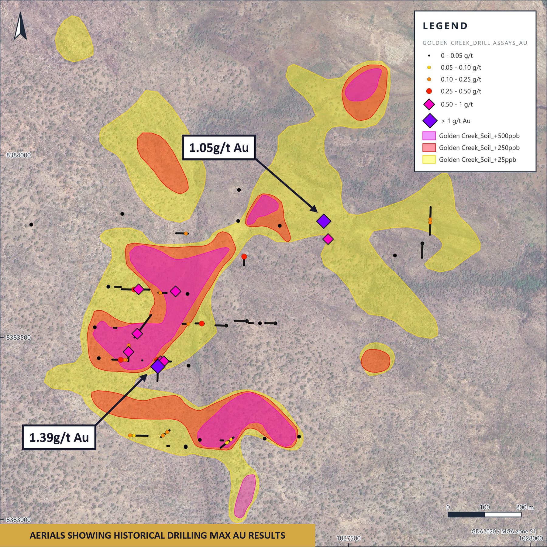
The Southern Anomaly is a 1.5 km coherent zone with a peak soil result of 6.04 g/t Au; ten samples exceed 1 g/t Au and 27 exceed 0.25 g/t Au. The original sampling used the fine fraction, which removes coarse gold; coarse-fraction re-sampling returned 16.7 g/t and 10.5 g/t Au, indicating the system tenor is materially higher than the original grid suggests.
One mineralised hydrothermal system, not three occurrences
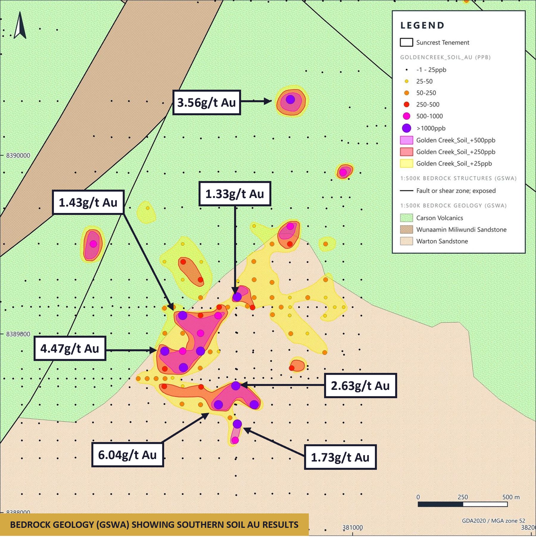
Between the Northern and Southern anomalies sits a coincident copper soil anomaly (peak 0.19% Cu) with a strong As–Pb–Zn halo and a documented colloform-textured epithermal vein at its core. Rock chips from this zone returned a peak of 0.491 g/t Au. The vein system geometrically links the two soil anomalies and the central copper zone, pointing to a single mineralised system.
An untested IP target beneath the best historical intercept
Historical RC drilling at the Southern Anomaly intersected a peak of 1 m @ 1.39 g/t Au from 7 m (W88-007), with eight further intercepts above 0.5 g/t Au. Mineralisation is hosted in micro-veined sandstone with disseminated pyrite. The historical assay method — a cyanide leach with ICP-MS finish — is known to under-report gold locked in pyrite or quartz, so reported grades likely understate the true tenor.
A 2006 six-line induced polarisation survey detected a strong chargeability response approximately 100 m below surface on Line 6, directly beneath drillhole E88-006 (1 m @ 1.05 g/t Au from 71 m) and continuing below end of hole. This chargeability anomaly has never been drilled and is the priority target for the next stage of work.
Golden Creek targets
Southern Anomaly
Priority target1.5 km coherent gold-in-soil anomaly with an untested IP chargeability anomaly directly beneath the best historical intercept.
Central copper zone
High priorityColloform epithermal vein at the heart of a 0.19% Cu soil anomaly with a strong base-metal halo.
Northern Anomaly
ModerateSmaller but strongly anomalous gold-in-soil zone (peak 0.647 g/t Au) on the same 12 km structural corridor.
Next steps
Previous owners walked away in 2003 for non-technical reasons — a diamond-focused joint venture, litigation and a merger that ended greenfield appetite — when gold traded at around A$510–610/oz, roughly a tenth of today's price. Suncrest's plan focuses on heritage clearances with the Balanggarra Traditional Owners, geological mapping, extensional soils on the Northern and Southern anomalies and re-establishment of access, followed by an expert-led epithermal field investigation ahead of any drill decision.